The need for training in spatial methods for archaeology and heritage management
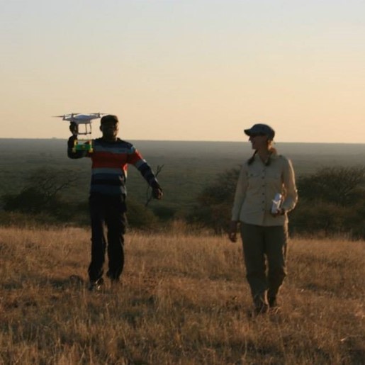
As geospatial and remote sensing techniques have matured from emerging specialties to ones seen as integral and increasing essential to scholarly practice, these technologies have revolutionized the study of form and space. The possibilities for digital humanities applications in archaeology and heritage management widely range in scale and application. Digital museums open remote collections for study and allow previously unanticipated metric-based analyses to be performed. For example, the Hampson Virtual Museum includes 440 artifacts associated with pre-Columbian peoples of the Mississippian River Valley stored in an excellent, but remote, Arkansas State Park Museum. Since publication in 2010, the virtual museum has allowed for access to the collections to scholars across the world. The ability to non-destructively study the internal structure of artifacts using microCT analysis has allowed archaeologists to document the seeds Chenopodium berlandieri subsup jonesianum (goosefoot), one of the “lost crops” that Native Americans domesticated before European arrival, inside of a fragile (and priceless) woven bag from AD20 that would have been damaged. Scaling up further, digital storytelling and archival websites like Rising Above can include interactive visualizations, which allows viewers to “walk-through” (virtually) a residential block at the WWII Japanese American internment camp site of Rohwer in southeast Arkansas and which is no longer physically preserved. Moving from collections to collecting data, LiDAR (Light Detection and Ranging), which detects natural and archaeological landscapes through major impediments such vegetation cover, is one of multiple methods used by the SPARC Program, and has helped to define pre-Columbian Chacoan (ancestral Puebloan) roads in New Mexico that prior aerial and pedestrian survey could not delineate.
However, the high costs of instrumentation and software combined with the expertise required for in-field operation and, equally important, for data processing, create a hurdle for archaeologists and heritage managers who aim to deploy them in research projects. In brief, there are a series of technical and logistical “bottlenecks” that humanists studying the past find themselves facing: entry-level geospatial courses exist in university coursework, but finding content tailored to archaeological and heritage problems is more difficult to come by; training is found either at the entry or expert level, with little resources or mentorship to bridge that gap; few opportunities exist to explore the potential of new equipment and software; and support systems for geospatial software or instruments are often developed for other industries (e.g. agriculture, forestry), making it difficult to find help. There exists a real need for guidance, mentorship, and training in this regard.
SAROI’s Objectives
The methods for recording and analysis of very detailed spatial information have derived from a number of different sources: improvements in computational methods, new instrumentation, markets for automated vehicles and drones, and others. These technologies have been developed far outside of the traditional humanities umbrella, but their characteristics are directly relevant. The first aspect of SAROI involves connecting archaeologists and cultural heritage practitioners to emerging and established methods in the high-density measurement and analysis of objects, structures, sites, and landscapes. This will be accomplished through the online training materials, in-person workshops, and mentorship that SAROI provides.
SAROI also recognizes that multiple approaches exist to the measurement and analysis of space for archaeology and heritage management. Depending upon his/her/their previous educational opportunities, a scholar may be familiar with only a portion, “siloed” from a suite of alternatives. Furthermore, the cost of the different modalities, in terms of monetary cost, operational training, equipment and software acquisition times, and processing time can vary widely. As part of the SAROI training scheme, online materials and workshop lectures will introduce Fellows to a broad set of methods, in addition to focused mentoring on the specific technique(s) related to their research interest(s). This ensures that Fellows can make multifaceted assessments of the costs and benefits of various methods in the near and long-term.
SAROI emphasizes that high-resolution spatial data requires unique consideration for their visualization, publication, and storage in a permanent repository. Resolution and file size can be difficult to access and can seem difficult to curate. SAROI curriculum will include best practices and strategies for the post-product organization, visualization, publication, and archiving of large, dense datasets. This will be accomplished through a second-year workshop on these end-stage issues that complements the first-year workshop on data collection and processing. These workshops follow the arc of Fellows’ projects from initiation through completion.
The SAROI Fellowship Program
Each SAROI Fellows will be provided:
- Access to pre-institute online training materials, including remote VDI access to ArcGIS Pro software (a common software used for spatial analysis), as desired by the Fellows;
- Support for travel and stay during both sessions of the Residency Institute, including:
- Travel stipends for transportation to/from the Institute
- Transport to/from airport as needed
- On-campus conference housing for the entirety of the Residency Institute workshops
- On-campus meal passes for breakfast and lunch during the residency workshops
- At the Residency workshops, training sessions that introduce a wide range of spatial methods that address the high-density measurement and analysis of objects, structures, sites, and landscapes, with specific emphasis on archaeological and heritage applications
- At the Residency workshops, small group mentoring sessions with an assigned Institute staff member based on the Fellows’ research interest (two Fellows with one Mentor), where Fellows develop and implement individual research projects
- Additional remote collaborative time between the residency sessions with each Mentor for the purposes of assistance with data collection or analysis, training/exposure to new techniques, professional development advice, and/or publication planning and grant writing